[This chronology was originally added to the Postcolonial Web by Joel P. Henderson, Brown University, in 1993, and has been reformatted and illustrated for the Victorian Web by Jacqueline Banerjee.]

"Terra Australis" finally mapped [Flinders, 1822].
1100 The issue of a "terra australis incognita" ("unknown southern land"), an issue in European thought in ancient times, is revived from the 12th century onward.
1432 Prior to documented history, there were Asian contacts. There is evidence for a Chinese landing near Darwin in 1432. Also, a southern land is mentioned in Arab and Chinese documents. [Possibly, Chinese astronomers made observations in Australia during the 6th century B.C.]
1550 [16th century] European maps show "jave la Grande," which was possibly a representation of Australia.
1567 Viceroys of Spain's American empire regularly sought new lands. One such expedition, from Peru, commanded by Alvaro de Mendana, discovered the Solomon Islands. He found gold and hoped he had found "the great southern land," and that Spain would colonize there.
1595 Mendana sails again, but fails to rediscover Solomons.
1605 [December] Pedro Fernandez de quiros, one of Mendana's officers and a man of the Counter-Reformation who desired that Catholicism should prevail in the southland, sets sail from Peru under Spain's King Philip III. De Quiros reaches the New Hebrides and returns, but Spanish officialdom is not persuaded to mount antoher expedition.
William Jansz of Amsterdam sails from Bantam to discover New Guinea. He reached Torres Straight weeks before Torre, and also names Cape Keer West on the west coast of Cape York Peninsula.
1611 Dutch ships sailing from Cape of Good Hope to Java accidentally sail too far east and hit Australia.
1616 [October 25-27] Dirck Hartog's Dutch "Eendracht" lands and leaves memorial at Shark Bay, Western Australia.
1626 [1616-1627] Pieter Nuyts, Dutch, explores about 1,000 miles of southern coast. Other Dutchmen add to knowledge of north and west.
1642 Governor General Anthony van Diemen of the Dutch East Indies commissions Abel Tasman to explore southward. he makes great circuit of the seas, spots Van Diemen's Land (latterly Tasmania), and explores New Zealand before returning to Batavia.
1644 Second expedition of Abel Tasman explores Australia's northern coast; thenceforth, New Holland was the name for the landmass. However, after this the Netherlands spend little more effort exploring.
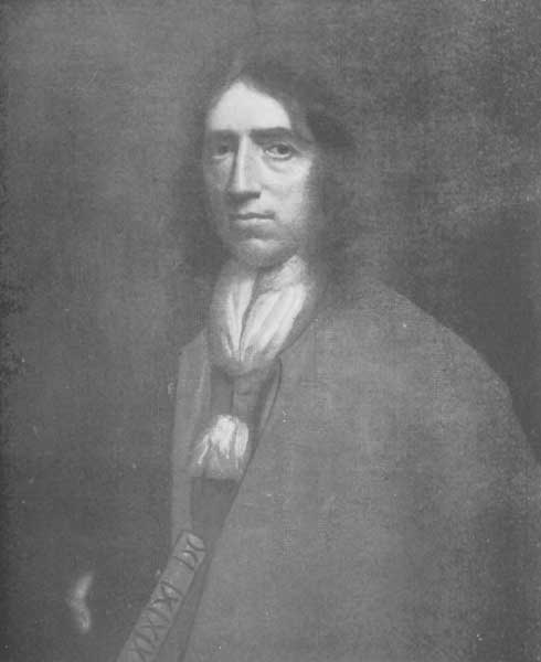
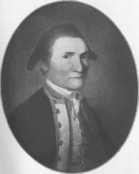
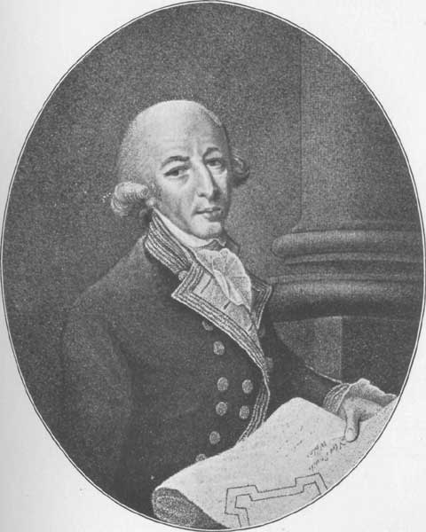
Three portraits from Becke and Jeffery: Left to right: (a) William Dampier (facing p. 38). (b) Captain Cook (facing p. 48). (c) Governor Phillip (facing p. 78).
1688 English pirate William Dampier relaxes on new Holland's northeastern coast. He publishes his Voyages and persuades the Admirality to back another venture.
1699 [1699-1700] William Dampier, on his second expedition, traverses the western coast for 1,000 miles and reported more fully than anyone previously, but in terms so critical of the land and its people that another hiatus resulted.
1750 [18th century, middle decades] There was much writing in Britain (and Europe, to a lesser extent) about the curiosities and possible commercial value of the southern seas and "terre australis incognita." The British government showed its interest by backing several voyages, and hopes flourished for a mighty empire of commerce in the eastern seas.
1768 [1768-1779] Capt. James Cook, on behalf of the British Admirality, makes three voyages. The first, the Endeavor, sights southeastern Australia on April 20,
1770 Cook lands several times, most notably at Botany Bay and Possession Island in the north, where on August 23 he claims the land and names it New South Wales. His later voyages add only a little to Australian exploration, but are both symptom and cause of strengthening British interest in the eastern seas — however, the voyages lead to settlement.
1772 Marion Dufresne of France skirts Tasmania and sees more of it, at least of the western coast, than Tasman had.
1775 [late 18th century] Bugis (Macassar) seamen certainly fish off Arnhem Land, in the Northern territory (and may have done so for generations). [Perhaps only effective resistance by the Aborigines against the Bugis reserves Australis for white colonization.]
1786 British government determines to settle New South Wales, with Lord Sydney (Thomas Townshend), secretary of state for home affairs, as the guiding authority. Arthur Phillip serves as commander of the expedition.
1787 [May 13] First fleet of British colonists sets sail.
1788 British colonization of New South Wales begins.
Original landing at Botany Bay is disastrous due to poor soil and water. Group relocates to superb harbor of Port Jackson, which Cook had marked but not explored.
Phillip immediately establishes outstation at Norfolk Island. [This station, abandoned in 1813, was revived in 1825 to provide a jail for convicts who further misbehaved in Australia.]
Convicts labor on government farms, while former convicts are given their own small plots.
Phillip governs until December 1792, seeing new South Wales through its darkest days of bad land, pests, disease, poor convict workers, hostile aborigines, and shrinking supplies.
Comte de la Perouse, French, visits Botany Bay.
1791 British navigator George Vancouver traverses and describes the southern shores described by Pieter Nuys in 1626-7.

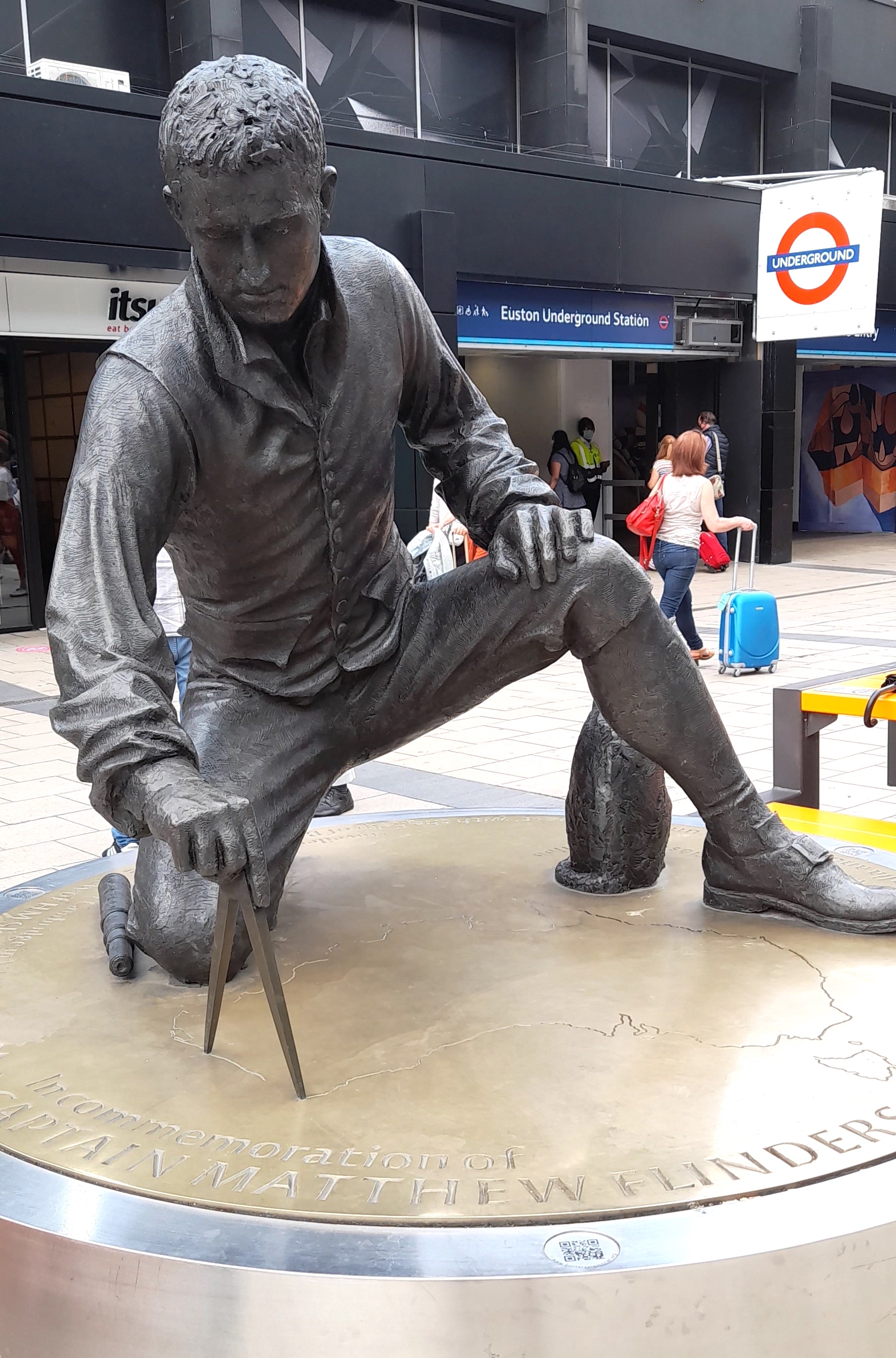
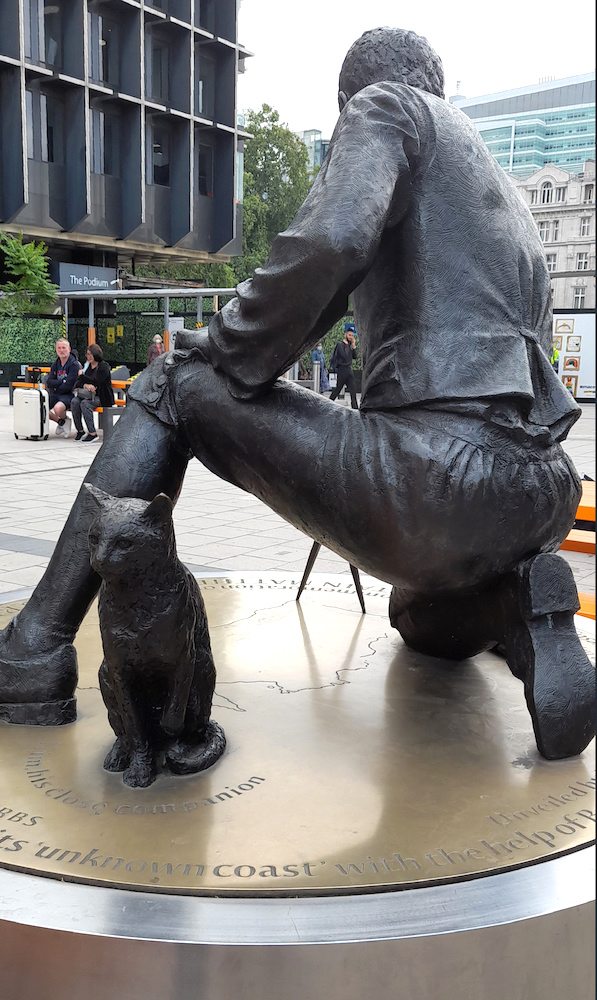
Left to right: (a) George Bass (Becke and Jeffery, facing p. 168). (b) and (c) Two views of the early post-settlement explorer Matthew Flinders commemorated outside Euston Station in London, with his cat, Trim. Sculpture by Mark Richards FRSS (2014). These photos by JB. Click to enlarge.
1795 George Bass, a naval surgeon, and Matthew Flinders, a naval officer (both British), become the most famous postsettlement explorers. They enter harbors near Botany Bay in 1795-6.
1797 Bass ventures further south, pushing around Cape Everard to Western port.
1798 Flinders charts the Furneaux Islands.
Flinders and Bass in the "Norfolk" circumnavigate Tasmania, establishing that it was an island.
1801 Flinders returns home, and is appointed to command an expedition that will virtually complete the charting of Australia. he commands from 1801-1804, and leaves no doubt that Australia is a single landmass. He urges that "Australia" replace "New Holland" as the name; the change receives official backing in 1817.
France sponsors expedition under Nicolas Baudin, similar to that of Flinders. French names are given to many features (including "Terre Napolean" for the southern coast), and though the expedition gathers much information, it does little completely new.
1817 Admirality expedition led by P.P King (1817-1822) helps fill in the gaps on the northern coast, from Arnhern Land to Cape York Peninsula.
"Australia" becomes official name of southern continent (rather than "New South Holland"), after the urgings of Matthew Flinders.
1838 Admirality expedition led by J.C. Wickham (1838-39) helps fills in the gaps from Arnhern Land to Cape York Peninsula. (like P.P. King, 1817).
1850 Australian Colonies Government Act.
1900 September 17. Queen Victoria proclaims Australia an independent member of the Commonwealth.
1947 Government offers to fund European immigration.
1962 Anglican Church becomes independent of the Church of England.
Bibliography
Becke, Louis, and Walter Jeffery. The Naval Pioneers of Australia. London: John Murrray, 1899. Availabe here on Project Gutenberg.
"Terra Australis." Exploration Maps and Charts. Project Gutenberg Australia. Web. 12 August 2021.
Last modified 12 August 2021 (images added)